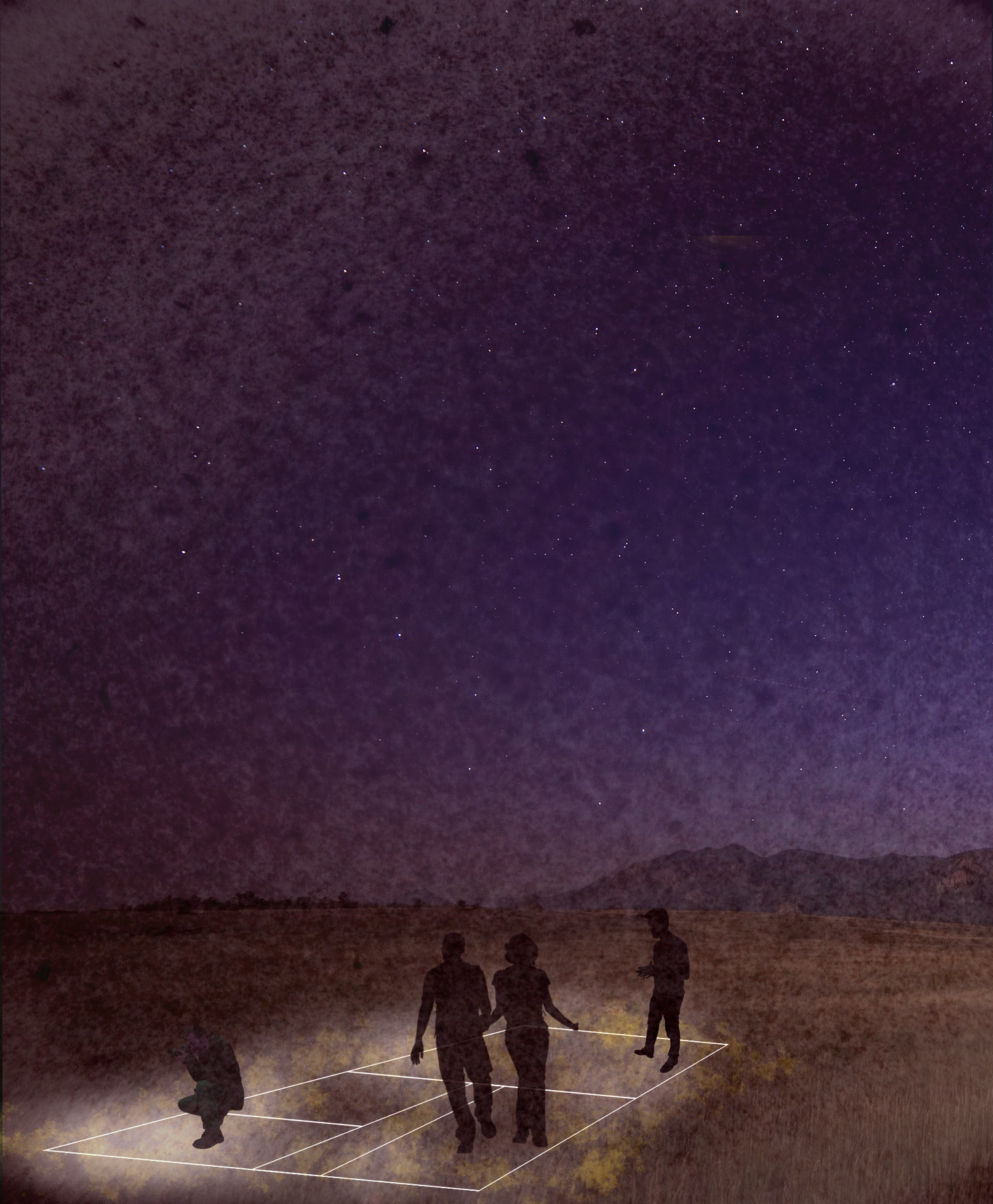
Nighttime light show along what used to be foundations of houses in the Red Zone.
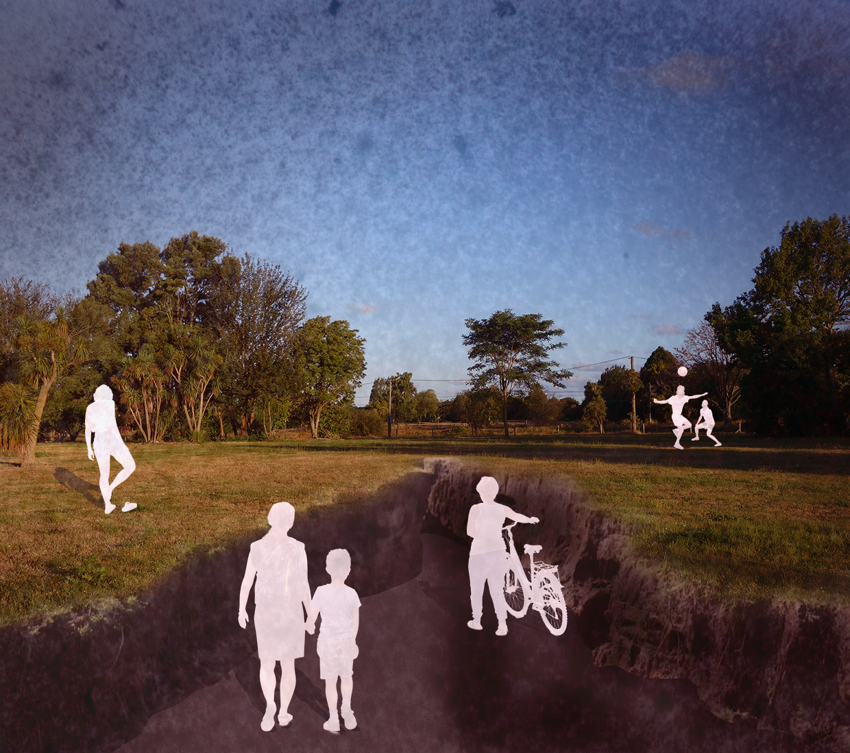
Paths through cracks that show the lateral spread that occurred in the Red Zone.
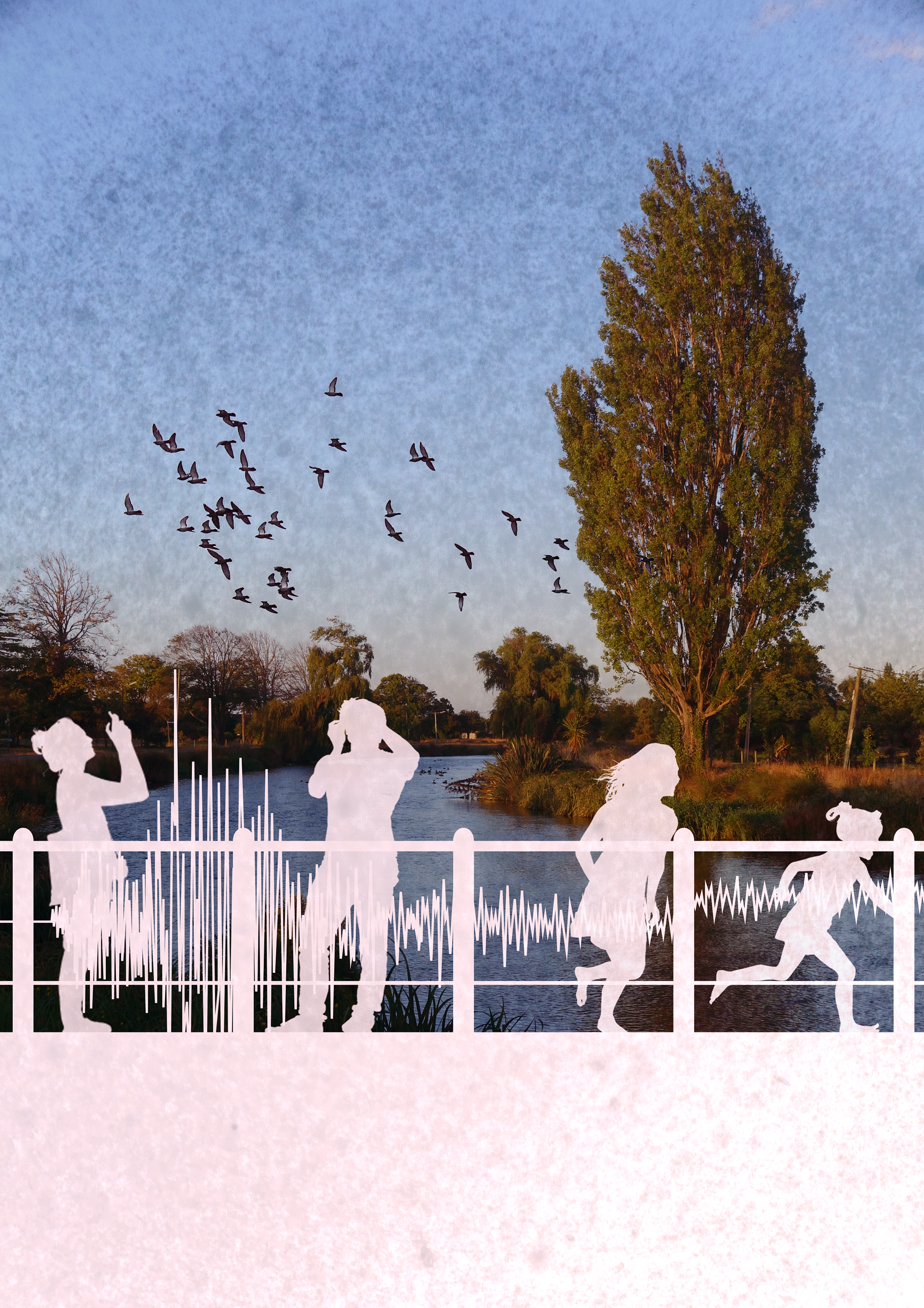
NEW ZEALAND STUDY ABROAD STUDIO | WINTER 2019 While on a UW study abroad program in New Zealand, our studio focused on conceptual redesign ideas for an interpretive trail in the residential red zone that was deemed uninhabitable after the 2010/2011 earthquakes in Christchurch. My individual projects for the group Memory, Connection + Being were on the science and history of the earthquakes as well as on a sea level rise path. The earthquakes vignettes portray interpretive trail stop proposals that go through an lighting display where house foundations used to be, a bridge across the river with seismic waves from the earthquakes on the railings, as well as a landform path going through a crack created in the land through lateral spreading. The sea level rise landing would mark the monthly highest tide on a lunar calendar that will create an interpretive trail in the river as water level increases.